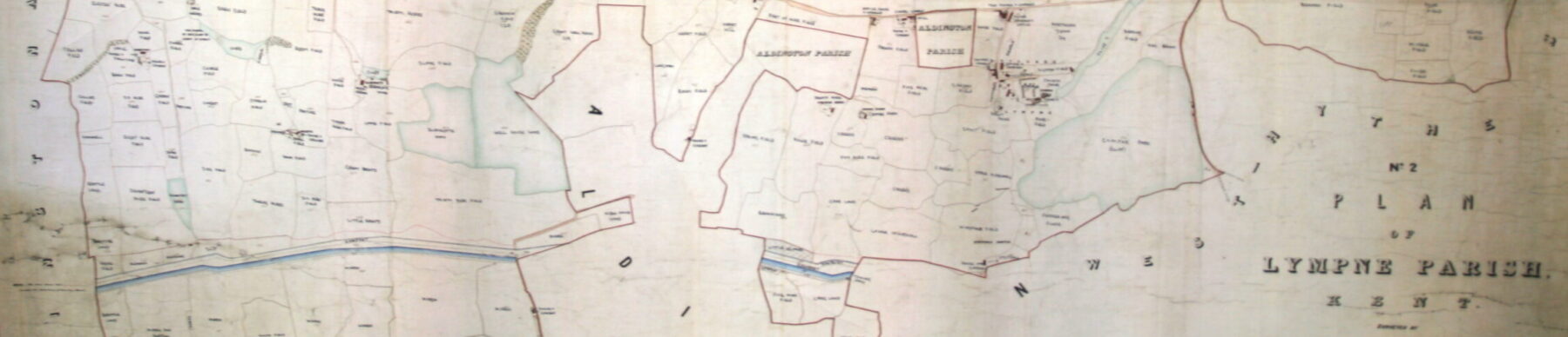
The 1841 Tithe Map
Tithes, originally a tenth of a parishioner’s produce in kind (crop, livestock or product, e.g. cheese) were payable for the support of the local parish church and clergy. In the mid C19th tithes were changed to cash payments. In the process detailed surveys were conducted in many parishes in England and Wales, often mapping them for the first time. The maps showed each piece of tithable land, identified by its tithe field number, linked to a written description in the ‘apportionment’ with details of ownership, land use and chargeable tithe rent.
These maps and apportionments are a valuable historical resource for understanding how the local landscape has been used over time and the changes or continuities in ownership.
SHAL members took advantage of the availability of these records to annotate a copy of the 1841 tithe map of Lympne with field names. It was a laborious process of matching the numbers to the apportionment entries and writing them onto a copy of the map. It is hoped to produce a higher quality image of the Lympne Parish tithe map which can be zoomed into at individual field level.